Jake Explains

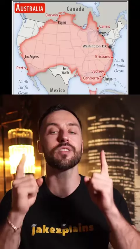
Mind blowing maps. Most maps use something called the Mercator projection. it stretches countries near the poles and shrinks those near the equators So the maps you’ve always seen are not really true to size..#maps#india#brazil#africa#geography
More